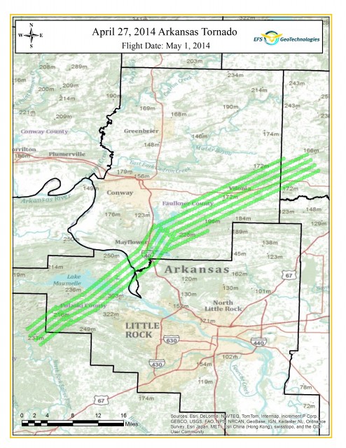
April 27, 2014 Arkansas Tornado Response
Sunday, April 27, 2014 a strong EF4 tornado struck central Arkansas and caused 15 fatalities in Pulaski, Faulkner, and White County Arkansas. The hardest impacted areas were the cities of Mayflower and Vilonia, Arkansas.

Thursday, May 1, 2014 EFS tasked one of its aerial photography collection aircraft to Central Arkansas to collect high resolution aerial photography of the impacted areas. This data will be usefull in the recovery process for mapping of damaged property.

Digital Aerial Photography products available from today’s flight are:
- One Foot Resolution Orthophotography of the area highlighted green in the map above.
- Half Foot Resolution Orthophotography of the cities of Mayflower, Vilonia, and El Paso
- Images may be delivered in Natural Color (RGB), Color Infrared (CIR), or Both (RGB-NIR)
Please contact EFS GeoTechnologies for information on any of the above products. Also, samples from today’s flight will be made available soon on our Facebook Page.
EFS GeoTechnologies is an Aerial Photography and GIS Services company based in Monticello, Arkansas. To learn more about EFS please visit www.EFSGEOTECH.com. Also, to receive updates from EFS you can follow them on Facebook and Twitter.


