Justin Rollans Joins EFS Team
July, 2018 – Justin Rollans accepted a position with EFS as Support Analyst
for EFS’s EDGE Team. Justin works with the EDGE Team on development, implementation, and customer support for various GIS projects. Justin is also a licensed commercial sUAS pilot. Born in East End, AR, Justin received his B.S. in Geographic Information Sciences from Louisiana Tech and a Masters in Geography from the University of Arkansas.
Levi Hayes Joins EFS Team
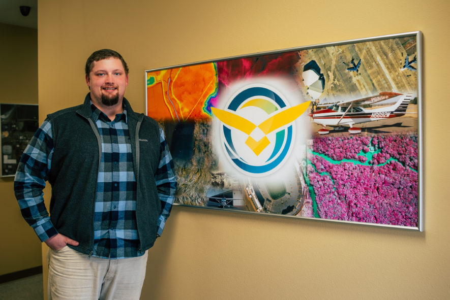
April 2, 2018 – Levi Hayes accepted a position with EFS as Pilot for EFS’s Aerial Photography Team. In addition to his aerial photography collection responsibilities, Levi has been assisting the Image Processing Team when not in the air. Born and raised in Van Buren, AR, Levi received a B.S. in Aviation, Professional Pilot Track with a minor in Business Administration from Henderson State University in Arkadelphia, AR. He is currently an instrument rated commercial single and multi-engine licensed pilot.

EFS Staff Update
TJ Andrews Joins EFS Team
September 4, 2017 – TJ Andrews accepted a position with EFS as Pilot for EFS’s Aerial Photography Team. In addition to his aerial photography collection responsibilities, TJ has been assisting with EDGE GIS projects when not in the air. Born in Chicago, IL, TJ received a B.S. in Aviation Flight Sciences with a minor in General Business from the College of Aviation at Western Michigan University. He is currently an instrument rated commercial single and multi-engine licensed pilot.

Hancock – Two Time World Champ!
November 25, 2017 – Logan Hancock, EFS Production Manager, won his second world title at the 82nd annual World’s Championship Duck Calling Contest held in Stuttgart, AR. Hancock won his first world championship in 2015 and followed that win with another major at the 2nd Annual Big Cypress National Duck Calling Championship hosted by Bass Pro Shops at the Pyramid in Memphis, TN in 2016.

Logan Hancock, “Royalty” Honored as World Champion Duck Caller from MonticelloLive on Vimeo.
Congratulations Logan!!
DeJon Butler Joins EFS Team
January 22, 2018 – DeJon Butler accepted a position with EFS as Support Analyst for EFS’s EDGE Team. DeJon is quickly learning how EDGE functions and will be available for support to our EDGE users soon. Born in Little Rock, AR, DeJon is a graduate of Pine Bluff High School in Pine Bluff, Arkansas and recently received a B.S. in Computer Information Systems from the University of Arkansas at Monticello. DeJon is married to his wife Kacey Butler and has three children: Messiah (9), Malachi (7), Kingston (5).

EFS GeoTechnologies is an Aerial Photography and GIS Services company based in Monticello, Arkansas. To learn more about EFS please visit www.EFSGEOTECH.com. Also, to receive updates from EFS you can follow them at Facebook and Twitter.
EFS News: Fall 2016
Jacob Peacock Joins EFS Team
August 15, 2016 – Jacob Peacock accepted a position with EFS as Pilot for EFS’s Aerial Photography Team. In addition to his aerial photography collection responsibilities, Jacob has been assisting the Image Processing Team when not in the air. Born in Minneapolis, MN, Jacob received a B.S. in Aviation Flight Sciences from the College of Aviation at Western Michigan University. He is currently an instrument rated commercial single and multi-engine licensed pilot.

Hancock Wins Again!
October 16, 2016 – EFS was proud to announce last year that our own Logan Hancock, EFS Production Manager, won the 2015 World Champion Duck Calling Championship held in Stuttgart, AR. He has continued his winning streak with a win at the 2nd Annual Big Cypress National Duck Calling Championshiphosted by Bass Pro Shops at the Pyramid in Memphis, TN. Good luck to Logan as he heads back to Stuttgart at the end of November to compete once again in the World Championship Duck Calling Contest!

EFS Participates In Inaugural SARGIS Meeting
November 01, 2016 – Seeing a need for improved communication and networking for GIS users in Southern Arkansas, EFS collaborated with other GIS leaders in our state and region to organize a new South Arkansas GIS Users Group. The group is currently Co-Chaired by Glen Dabney, EFS President, and Dr. John C. Dennis, University of Arkansas at Monticello. Dabney and Dennis were assisted in the organization of the meeting by Auddy Doss with EFS and Cliff Ryland with Kingwood Forestry Services, Inc. For the first meeting attendees heard presentations from representatives with Monticello Economic Development Commission, Arkansas Game and Fish Commission, Arkansas Geographic Information Office, State Land Surveyor’s Office, and Navigation Electronics Inc. on their individual applications of geospatial technologies in daily activities. EFS was proud to see several EFS EDGE users attend the meeting. The group is looking forward to meeting again in the Spring for additional networking and information sharing opportunities.
EFS GeoTechnologies is an Aerial Photography and GIS Services company based in Monticello, Arkansas. To learn more about EFS please visit www.EFSGEOTECH.com. Also, to receive updates from EFS you can follow them at Facebook and Twitter.
Lincoln County, Arkansas EDGE Goes Public

Lincoln County, Arkansas has been using EFS’s EDGE as their One County Map since October of 2014. Lincoln County Officials recently decided to make their EDGE GIS Mapping site available to the Public. The below is taken from their website announcing the release:
Lincoln County residents can search through a wealth of county information in one centralized location. The county’s GIS (Map) data is available to the public the instant it is created or updated by way of the EDGE (GIS site). The mapping (GIS) program was a joint effort between the county and EFS GeoTechnologies of Monticello. The map program contains a wide array of data concerning parcels and ownership, addresses, flood zones, fire districts, utility territories, and school districts just to mention a few of the more than 40 data sets. The program also includes aerial photography of the county. In the program there are tools to create bookmarks, conduct searches, find address, do drawings with measurements, find GPS points and print maps.One of the largest benefits to county residents is the ability to view data that would normally be available only during business hours (Monday through Friday). (Source: http://ee-lincoln.ark.org/services)
To see the Lincoln County EDGE public viewer go to www.efsedge.com/lincoln (Desktop Version) or www.efsedge.com/lincoln/mobile (Smartphone Version).
EFS GeoTechnologies is an Aerial Photography and GIS Services company based in Monticello, Arkansas. To learn more about EFS please visit www.EFSGEOTECH.com. Also, to receive updates from EFS you can follow them at Facebook and Twitter.
Staff Notes: Hancock and Gilbert Receive Local Honors
Logan Hancock
After winning the 80th Annual World Champion Duck Calling Contest, EFS’s Logan Hancock has been honored from the City of Monticello and Arkansas House of Representatives. Monticello’s Mayor Zack Tucker proclaimed December 7, 2015 as Logan Hancock day in the City of Monticello and Arkansas State Representative Shellia Lampkin presented Logan with a citation from the House of Representatives acknowledging his achievement in the competition.
December 07, 2015 – Logan Hancock was honored by Monticello’s Mayor, Zack Tucker, proclaiming December 7, 2015 was Logan Hancock Day in the City of Monticello.

Logan Hancock with State Representative Shellia Lampkin at the 2015 Monticello Chamber of Commerce and Monticello Economic Development Banquet.
Michael Gilbert
At the 2015 Monticello Chamber of Commerce/Economic Development banquet EFS’s Michael Gilbert was named Drew County’s 2015 Outstanding Young Leader of the Year. Michael was chosen for the award based on his contribution to the community through volunteering with his church and other programs.
Logan Hancock and Michael Gilbert at the Drew County MEDC/Chamber of Commerce Banquet.
EFS GeoTechnologies is an Aerial Photography and GIS Services company based in Monticello, Arkansas. To learn more about EFS please visit www.EFSGEOTECH.com. Also, to receive updates from EFS you can follow them at Facebook and Twitter.
EFS’s Hancock Wins World Championship Duck Calling Contest

November 29, 2015 – Logan Hancock, EFS Spatial Information Systems Specialist, recently placed first in the 80th Annual World Championship Duck Calling Contest held in Stuttgart, Arkansas. The annual contest held as part of Stuttgart’s Wings Over the Prairie Festival featured 65 competitors. (Photo Source: https://www.facebook.com/WCDCCStuttgart/)
Logan has been competing in Duck Calling Contest since 2005. In the previous two World Championship competitions he has placed in the top 10 with a 5th place finish in 2014 and 7th place finish in 2013.
Congratulations Logan!
EFS GeoTechnologies is an Aerial Photography and GIS Services company based in Monticello, Arkansas. To learn more about EFS please visit www.EFSGEOTECH.com. Also, to receive updates from EFS you can follow them at Facebook and Twitter.
2015 EFS Company News Update
Aerial Photography
The EFS Image Processing Team has completed all Winter Mapping Projects from the 2014-2015 season and are currently working on summer/fall forestry site prep imagery as well as getting prepared for the 2015-2016 Winter Mapping Season which will begin around the middle of December.
EDGE
The EDGE team has been busy presenting EDGE in 2015 and are excited for the opportunity to work with several new counties and cities in the coming months.
ONE COUNTY MAP
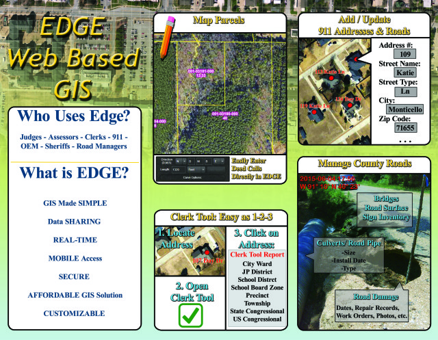
EDGE is designed to be used as “The Map” for the County. It is more than an Assessor’s Tool for Parcel Mapping or Judge’s system for County Road Management. EDGE places all data being mapped in the County in one central location. For the counties currently using EDGE it has become the source for the most up to date map of the County.
EDGE For Cities
EDGE is being used by multiple cities as well. Cities in Arkansas and Mississippi are using EDGE to keep track of the utility systems such as water and sewer lines and associated features. New in 2015 is also the customized Nuisance Property tracking module. The Nuisance Property module can be customized to allow your city to not only keep track of where your nuisance properties are but also what phase they are in for remediation.
Publicly Available EDGE Sites
Currently the following sites have been opened to the public to view the County’s EDGE Map:
(*To View on Smartphone add /Mobile to end of above link*)
Conferences Attended
EFS has had a busy conference schedule this year. Below is a list of conferences attended in 2015:
- January 27-29 – Ouachita SAF Conference
- February 08-10 Arkansas County Judges Winter Conference
- June 09-12 Arkansas County Assessors Summer Conference
- June 21-24 Association of Consulting Foresters Conference
- June 24-26 Arkansas Municipal League Conference
- August 04-07 Association of Arkansas Counties Conference
- September 01-04 Arkansas GIS Users Conference
- September 30-October 02 – Arkansas County Judges Fall Conference
- October 26-29 – Arkansas County Assessors Fall Conference
Staff Notes
Bussell Joins EFS Team

September 30, 2015 – Chris Bussell of Monticello, AR accepted a position with EFS to join the Image Processing Team. Bussell graduated with a B.S. in Spatial Information Systems (Surveying Option) from the University of Arkansas at Monticello in 2010. Before attending UAM in 2006 Chris served in the United State Army from 2001-2006 as a Network Systems Operator/Maintainer and was deployed to Iraq in January 2005.
Hartshorn Named Vice President of EFS

July 27, 2015 – The EFS Board of Directors named James Hartshorn, Director of Product Development, as Vice President of Eagle Forestry Services, Inc. / EFS GeoTechnologies. James will continue in his role as lead developer of EDGE while taking on more responsibilities in the day to day management of EFS.
Dabney Appointed to Monticello Municipal Airport Commission

January 22, 2015 – The Monticello City Council approved the appointment of EFS President, Glen Dabney, to serve on the City’s Airport Commission. Pictured above Monticello’s Mayor Zack Tucker (left) presents Glen Dabney (right) with the appointment resolution from the City Council.
EFS GeoTechnologies is an Aerial Photography and GIS Services company based in Monticello, Arkansas. To learn more about EFS please visit www.EFSGEOTECH.com. Also, to receive updates from EFS you can follow them on Facebook and Twitter.
Arkansas Assessors’ Summer Meeting 2014
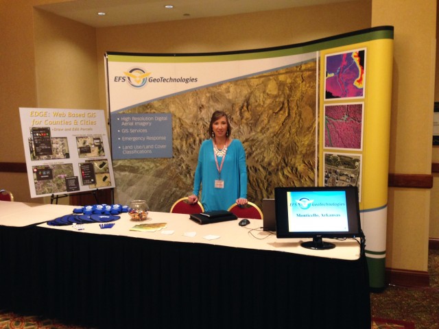
Arkansas Assessors, stop by EFS GeoTechnologies’ booth at the upcoming Summer Assessors’ Meeting at the Embassy Suites in Rogers, Arkansas, June 10-13. Auddy Doss and Erica Byers will be attending the conference and will be available each day to discuss your Aerial Photography and GIS/Mapping needs. For over 27 years EFS has provided High Resolution Aerial Photography and GIS services. EFS is your LOCAL in state provider of these services and count it an honor to work with Arkansas Counties in designing a program for Aerial Photography and GIS. Along with Aerial Photography be sure to ask about updates to EFS EDGE. EDGE allows for the sharing of GIS data across multiple county offices and provides options for the maintenance of your Parcel maps and other GIS data. The EDGE website was designed especially for Arkansas counties. The EDGE Mobile app can be configured as a mobile solution for your staff as well as an avenue to share your work with county constituents. Auddy and Erica look forward to the conference and the opportunity to discuss how EFS may serve your county.
EFS GeoTechnologies is an Aerial Photography and GIS Services company based in Monticello, Arkansas. To learn more about EFS please visit www.EFSGEOTECH.com. Also, to receive updates from EFS you can follow them on Facebook and Twitter.
Hartshorn, Guest Speaker at Awards Banquet
James Hartshorn, EFS Director of Product Development was recently invited to speak at Hamburg High School annual student awards banquet. To read more about his presentation and the ceremony you may click on the above photo to be directed to the Ashley County Ledger’s website.
EFS GeoTechnologies is an Aerial Photography and GIS Services company based in Monticello, Arkansas. To learn more about EFS please visit www.EFSGEOTECH.com. Also, to receive updates from EFS you can follow them on Facebook and Twitter.

